Canada and France share a maritime border, despite the ejection of France from North America in the Seven Years' War. Article 6 of the 1763 Treaty of Paris allowed France to retain the tiny islands of St. Pierre and Miquelon in the Gulf of St. Lawrence to facilitate French fishing in the region. France retained control over them despite losing the Napoleonic Wars to Britain and her allies.
During the Twentieth Century, the great powers gained increasing interest in directly controlling the seas from which they were able to extract wealth in the form of oil. So the precise border between these French islands and the now independent Canada was not a matter to ignore.
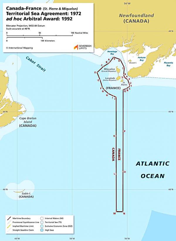
The two nations concluded arbitration in 1972, leading to the sea borders illustrated above. The map is provided by Sovereign Limits, a website about maritime boundaries. France maintains a sizeable Exclusive Economic Zone dangling inside otherwise Canadian waters.
-via Amazing Maps


Commenting on Neatorama will earn you NeatoPoints!