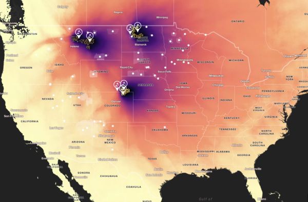
The Air Force has plans to upgrade and re-arm existing obsolete nuclear missile sites in the US. Maps Mania alerts us to an interactive map project concerning these missile silos. The locations are common knowledge thanks to satellite technology. Under the Nuclear Sponge theory, these missiles silos are located in relatively low population areas of the country, under the assumption that in a nuclear war, the enemy would attack these silos first, which would then affect fewer people. Small consolation for those who live in these areas.
However, nuclear fallout following such an attack would cover much larger areas, depending on wind and weather. USA Today posted an interactive map showing which areas would be most affected under different weather models, indicating that highly-populated areas would not be safe even if a nuclear attack was limited to the silos. You can also explore the original map called Under the Nuclear Cloud without all the scrolling context at Columbia University. -via Nag on the Lake


Commenting on Neatorama will earn you NeatoPoints!