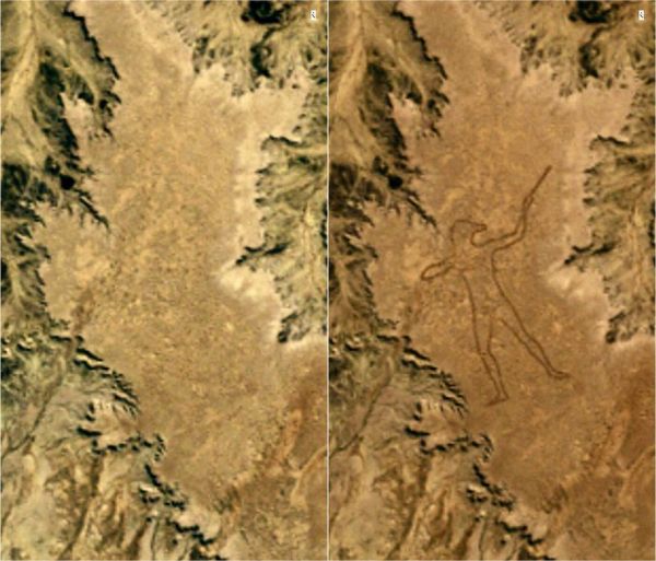
In 1998 in the Australian Outback, 36 miles from the tiny town of Marree, an almost two-mile long drawing of a man appeared in the dessert. The satellite image on the left was taken on May 27, 1998, and the image on the right was taken on June 12th. Sometime in between, a figure of an Aboriginal hunter was plowed into the ground. No one noticed it until July, when a set of faxes were sent to Marree, and a local pilot went out to take a look.
Who drew the Marree Man? It wasn't the local Aboriginals, who own the land. They were angry that someone had plowed through their ancestral land and damaged the protected native plants. A local man who had a tractor and was said to have access to the then-new technology of GPS was suspected. An American flag was found on the ground at the work, throwing suspicion on American defense workers about three hours away. An Australian artist said he did it, but his story wasn't that credible. Tour operators were suspected, because they would have profited from the art. More clues were unearthed when a hotel owner began to restore the Marree Man in 2015, after erosion had blurred the lines. Although there are plenty of suspects, we may never know exactly who carved the geoglyph into the Outback.
(Image credit: USGS/NASA)