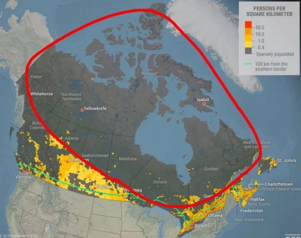
By area, Canada is the second largest country on earth (after Russia and discounting Antarctica), but it's 37th in population. A population map of Canada shows where the people are concentrated, right near the southern border. Most of that border between the US and Canada is at the 49th parallel, yet the majority of Canadians live south of that parallel in the east. Why don't more people live in the north? Duh- because it's cold up there. But honestly, there's a lot more to it.
Canada's population is not just limited to the south- it's concentrated in three areas that are widely separated from each other. Tomas Pueyo at Uncharted Territories breaks down the historical, geological, and meteorological reasons that the St. Lawrence River, the Palliser Triangle, and Vancouver have so many people while the rest of the country is wide open spaces. He has an awful lot of interesting maps in the explanation. -via Nag on the Lake